Would you like to be let in on a super sneaky, way-cool tip on how to get a photo, and a view of an assisted living facility or a residential senior care home? It’s pretty easy, and a great way to inspect the facility’s exterior, as well as the surrounding neighborhood in an interactive, ‘almost-live’ view sort of way.
To do this, simply copy a facility’s address into google maps.
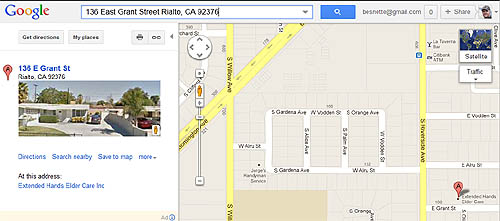
Then, once the map comes up with the facility’s location, you’ll see not only the map, but in the left-hand column, you will most often see a photo grab of the address, and the exterior of the home or facility, as seen here:
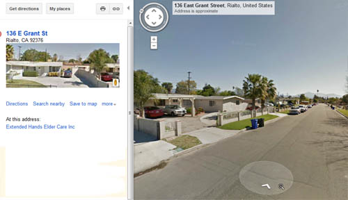
Once on this page, if you click on the photo to the left, Google’s awesome ‘street view’ application will come up. From there you can pan 360 degrees, using the controls, to get a view of the entire area.
Additionally, you can actually take a ‘virtual drive’ down the street to see what is nearby, as you can see here:
Unfortunately, street view does not take you inside the houses or facilities, and it won’t serve you lunch either, but it is really the next best thing to getting an almost real-time tour of a facility’s location, exterior, and surrounding neighborhood.